![](/images/other/stat-length.png)
![Randonnée V.T.T. Le Monastère - Rodez Agglomeration - Circuit 2 - Les deux églises - Photo](https://media.geolcdn.com/t/1900/400/796e1274-6ffc-4ddb-aa65-0bd15f3091ac.jpg&format=pjpeg&maxdim=2)
Rodez Agglomeration - Circuit 2 - Les deux églises
randoruthene
Utilisateur
![Longueur](/images/other/stat-length.png)
![Altitude max](https://static1.geolcdn.com/siteimages/upload/files/1508320355ic_sort_altitude_max_24dp.png)
![Dénivelé positif](https://static1.geolcdn.com/siteimages/upload/files/1508320355ic_sort_den_pos_24dp.png)
![Km-Effort](/images/other/stat-length.png)
![Altitude min](https://static1.geolcdn.com/siteimages/upload/files/1508320355ic_sort_altitude_min_24dp.png)
![Dénivelé négatif](https://static1.geolcdn.com/siteimages/upload/files/1508320355ic_sort_den_neg_24dp.png)
![Boucle](https://static1.geolcdn.com/siteimages/upload/files/16400158638029165_repeat_loop_refresh_sync_direction_icon.png)
![V.T.T.](https://static1.geolcdn.com/sitytour/trail-icons/202.png)
1h59
Difficulté : Moyen
![Scannez ce code QR pour ouvrir la randonnée dans l'application SityTrail](https://capi.geolives.com/qq0zvz2zws4bq2lad0pu/sitytour/trails/2492059/qr.png?size=200)
Application GPS de randonnée GRATUITE
À propos
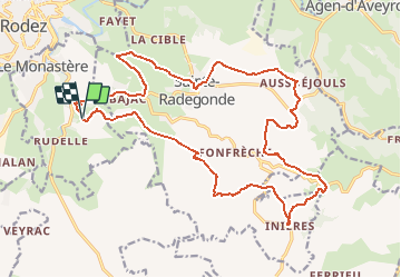
Randonnée V.T.T. de 24 km à découvrir à Occitanie, Aveyron, Le Monastère. Cette randonnée est proposée par randoruthene.
Description
Espace VTT Rodez Agglo - 400 km de chemins balisés - 18 circuits labéllisés FFC
Vous pourrez découvrir durant ce parcours :
• Le Domaine de Combelles et son parc équestre, situés sur la Commune du Monastère.
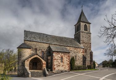
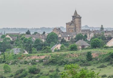
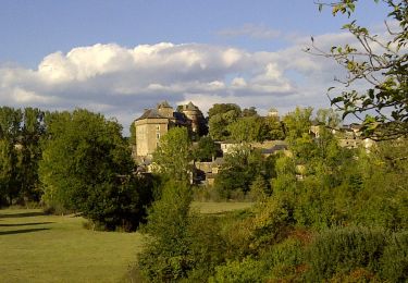
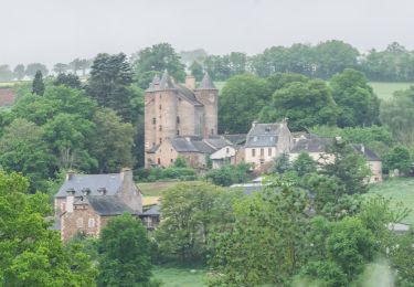
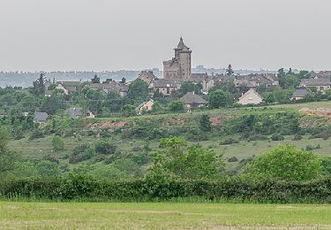
• Deux églises fortifiées des XIVe et XVe siècles à Sainte-Radegonde et Inières :
- l’église de Sainte-Radegonde défendue par trois tours et des échauguettes
- l’église Saint-Jacques dans le village d’Inières, massive et couronnée de mâchicoulis
• Un magnifique point de vue sur Rodez et sa cathédrale.
Localisation
Commentaires
Randonnées à proximité
![Randonnée A pied Rodez - Randonnée de Rodez Agglomération Circuit n°2 - Layoule - Photo](https://media.geolcdn.com/t/375/260/f3313b5c-ce65-4318-890f-b27e77cbc381.jpeg&format=jpg&maxdim=2)
![A pied A pied](https://static1.geolcdn.com/sitytour/trail-icons/100.png)
A pied
![](/images/other/stat-length.png)
![](https://static1.geolcdn.com/siteimages/upload/files/16400158638029165_repeat_loop_refresh_sync_direction_icon.png)
![Randonnée A pied Onet-le-Château - Circuit 16 Moulin de cantarane - Photo](https://media.geolcdn.com/t/375/260/235c9653-a6cd-4d3e-a1cf-bad11a8eacbc.jpeg&format=jpg&maxdim=2)
![A pied A pied](https://static1.geolcdn.com/sitytour/trail-icons/100.png)
A pied
![](/images/other/stat-length.png)
![](https://static1.geolcdn.com/siteimages/upload/files/16400158638029165_repeat_loop_refresh_sync_direction_icon.png)
![Randonnée A pied Sainte-Radegonde - Circuit 14 Sainte-Radegonde - Photo](https://media.geolcdn.com/t/375/260/bfa8cc26-1f2d-4982-8155-a549091f1797.jpeg&format=jpg&maxdim=2)
![A pied A pied](https://static1.geolcdn.com/sitytour/trail-icons/100.png)
A pied
![](/images/other/stat-length.png)
![](https://static1.geolcdn.com/siteimages/upload/files/16400158638029165_repeat_loop_refresh_sync_direction_icon.png)
![Randonnée A pied Le Monastère - Circuit 11 Le Monsastère - Photo](https://media.geolcdn.com/t/375/260/7f6d0b8f-df20-456a-b847-03e2bacf2452.jpeg&format=jpg&maxdim=2)
![A pied A pied](https://static1.geolcdn.com/sitytour/trail-icons/100.png)
A pied
![](/images/other/stat-length.png)
![](https://static1.geolcdn.com/siteimages/upload/files/16400158638029165_repeat_loop_refresh_sync_direction_icon.png)
![Randonnée A pied Luc-la-Primaube - Circuit 10 La Capelle Saint-Martin - Photo](https://media.geolcdn.com/t/375/260/5a6f95bc-d295-4447-ad49-16f1eeefb33a.jpeg&format=jpg&maxdim=2)
![A pied A pied](https://static1.geolcdn.com/sitytour/trail-icons/100.png)
A pied
![](/images/other/stat-length.png)
![](https://static1.geolcdn.com/siteimages/upload/files/16400158638029165_repeat_loop_refresh_sync_direction_icon.png)
![Randonnée A pied Luc-la-Primaube - Circuit 9 Planèzes - Photo](https://media.geolcdn.com/t/375/260/5a6f95bc-d295-4447-ad49-16f1eeefb33a.jpeg&format=jpg&maxdim=2)
![A pied A pied](https://static1.geolcdn.com/sitytour/trail-icons/100.png)
A pied
![](/images/other/stat-length.png)
![](https://static1.geolcdn.com/siteimages/upload/files/16400158638029165_repeat_loop_refresh_sync_direction_icon.png)
![Randonnée A pied Olemps - Circuit 8 Le Viel Olemps - Photo](https://media.geolcdn.com/t/375/260/eb25fc91-7c0e-4dc4-8e2b-7796a039a790.jpeg&format=jpg&maxdim=2)
![A pied A pied](https://static1.geolcdn.com/sitytour/trail-icons/100.png)
A pied
![](/images/other/stat-length.png)
![](https://static1.geolcdn.com/siteimages/upload/files/16400158638029165_repeat_loop_refresh_sync_direction_icon.png)
![Randonnée A pied Rodez - Via Piodensis - Rodez - Photo](https://media.geolcdn.com/t/375/260/9dd22525-ee44-4bef-976c-a9f96d351214.jpeg&format=jpg&maxdim=2)
![A pied A pied](https://static1.geolcdn.com/sitytour/trail-icons/100.png)
A pied
![](/images/other/stat-length.png)
![](https://static1.geolcdn.com/siteimages/upload/files/16400158638029165_repeat_loop_refresh_sync_direction_icon.png)
![Randonnée A pied Sainte-Radegonde - Sainte-Radegonde - Photo](https://media.geolcdn.com/t/375/260/8f1cb6a9-35c6-49f1-bd01-3c3a300c688b.jpeg&format=jpg&maxdim=2)
![A pied A pied](https://static1.geolcdn.com/sitytour/trail-icons/100.png)
A pied
![](/images/other/stat-length.png)
![](https://static1.geolcdn.com/siteimages/upload/files/16400158638029165_repeat_loop_refresh_sync_direction_icon.png)